Spur Energy Partners New Mexico Operator Brief: Eddy County Permit And Spud Follow-Through
Spur Energy Partners permit and reported-spud activity in Eddy County, New Mexico, with source dates, operator context, and data limits.
By Johnathan · Reviewed by EnergyNetWatch Research · Maintained page · Content updated 2026-08-08
Living operator brief
This page is maintained as an operator intelligence brief, with refreshed permits, spuds, production windows, counties, source labels, and watch items where available.
Key Takeaways
- Spur showed 18 New Mexico permits and 18 reported-spud rows in the current 90-day window.
- New Mexico OCD lists Spur Energy Partners LLC as operator 328947 with 1,387 active well entities and 11 pending APDs.
- Eddy carries 17 permits and 17 reported-spud rows; Lea adds one of each in the same window.
EnergyNetWatch refreshed New Mexico permit and reported-spud records for Spur Energy Partners LLC on August 8, 2026. The current pull covers source rows through July 31 for permits and July 29 for reported spuds.
At A Glance
| Field | Reviewed signal |
|---|---|
| Operator label | Spur Energy Partners LLC |
| New Mexico OCD operator ID | 328947 |
| OCD operator role | Well Operator |
| OCD active well entities | 1,387 |
| OCD pending APDs | 11 |
| EnergyNetWatch public county focus | Eddy County |
| EnergyNetWatch 90D permits | 18 |
| EnergyNetWatch 90D reported-spud rows | 18 |
| EnergyNetWatch 12M permits | 55 |
| Latest matched operator permit | July 24, 2026 |
| Latest matched operator reported spud | July 17, 2026 |
Latest New Mexico Source Clock
This page uses the August 8 current operator pull. The New Mexico source clocks reached permit records through July 31, 2026 and reported spuds through July 29, 2026. Complete modeled production was available through May 2026, but production is not included in the counts above.
The state dates describe source availability; the operator counts above are the matched Spur rows from that pull.
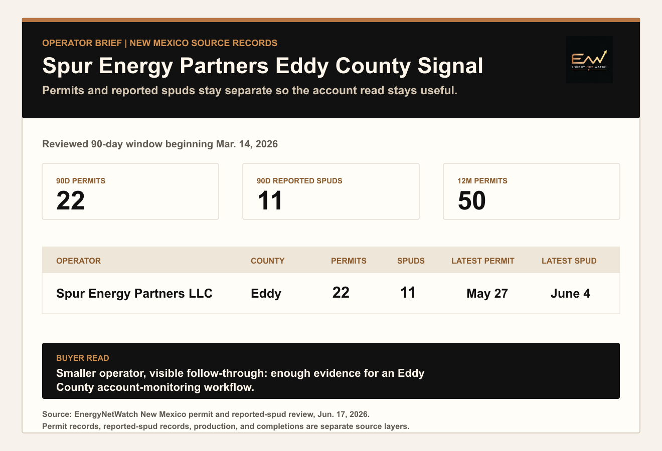
EnergyNetWatch read-only refresh run August 8, 2026. Operator labels are shown as filed. County labels use New Mexico county fields where populated.
Reviewed Operator Snapshot
| Signal | Reviewed signal |
|---|---|
| Eddy County permits, 90D window | 17 |
| Eddy County reported-spud rows, 90D window | 17 |
| Matched New Mexico permits, trailing 12M | 55 |
| New Mexico source freshness | Permits through July 31; reported spuds through July 29 |
Spur is not the largest operator in the Eddy County table.
The reason it gets a brief is the permit-to-spud signal. In the current window, the public snapshot shows 18 permits and 18 reported-spud rows for the same operator label across New Mexico, with Eddy carrying 17 of each.
That is enough to put the account on a watchlist.
Request EnergyNetWatch access to see the current Spur/Eddy permit-spud table, maps, exports, alerts, and API options.
Eddy County Snapshot
| Metric | Reviewed signal |
|---|---|
| Operator/county | Spur Energy Partners LLC / Eddy County |
| 90D permits | 18 |
| 90D reported-spud rows | 18 |
| 12M permits | 55 |
| Latest matched operator permit | July 24, 2026 |
| Latest matched operator reported spud | July 17, 2026 |
The main signal is permit-to-spud follow-through in Eddy County.
- Permits show filed activity.
- Reported spuds show drilling-start evidence.
- The county label keeps the activity from turning into a vague statewide claim.
- Source dates show whether the table is current enough for follow-up.
Where Spur Is Active
The public EnergyNetWatch snapshot shown here is Eddy County only.
The New Mexico OCD operator detail page for operator 328947 lists Spur Energy Partners LLC as a Well Operator with 1,387 active well entities, 205 active facility entities, and 11 pending APDs. That OCD page is useful background, but it is not the same as the EnergyNetWatch permit/spud table above and was not re-counted in this pull.
The EnergyNetWatch signal is narrower:
| Question | Public answer in this brief |
|---|---|
| Which operator label? | Spur Energy Partners LLC |
| Which county is shown? | Eddy County |
| Is the evidence permit-stage only? | No. The snapshot also shows reported spuds. |
| Is this a production ranking? | No. Production is a separate source layer. |
| Is this a full current export? | No. It is a selected public snapshot. |
Infrastructure And Midstream Signals
| Layer | Public page treatment | App follow-up |
|---|---|---|
| OCD facility entities | The public page shows high-level OCD facility-entity context, not a facility lead list. | Review source-linked facility rows, surface context, county fields, and map locations inside EnergyNetWatch. |
| Midstream / gathering | Not asserted from this public snapshot. | Check operator-linked midstream and produced-water context only where source rows support it. |
| Why limited here | The public brief proves the evidence category exists without giving away the current account-ready table. | Request the current Spur permit, spud, facility, map, export, alert, and API package. |
Recent Permit And Spud Signals
| Record type | Count | What it tells you |
|---|---|---|
| 90D permits | 18 | Spur had current filed activity in Eddy and Lea. |
| 90D reported-spud rows | 18 | The same operator view also had drilling-start evidence. |
| 12M permits | 55 | The current 90D count is part of a broader trailing-year activity base. |
This is the account-screening use case.
A service company, supplier, or commercial user does not need a broad company description to act on this. They need the permit rows, reported-spud rows, dates, county fields, and map/export options.
Eddy County Comparison
Spur's current row is useful because the reported-spud count matches the permit count in the matched 90-day window. Eddy carries nearly all of that activity, with Lea retained as a second county row.
What To Request
The requestable table is:
Request the current Spur Energy Partners Eddy County permit and reported-spud table.
Keep the request simple: current permit/spud table, maps, exports, alerts, and API options.
Frequently Asked Questions
Is this saying 11 wells were completed?
No. The table shows reported-spud records, not completion records. A reported spud is drilling-start evidence and is separate from completion, production, or sales data.
Why focus on Spur if larger operators have more permits?
Because the row shows a clean permit/spud follow-through signal in Eddy County. It is an account-monitoring example, not a statewide operator ranking.
Is this a New Mexico production ranking?
No. This is a permit and reported-spud brief. Production is a separate source layer with a different reporting cadence.
What does EnergyNetWatch add beyond the public table?
The public article shows selected rows and rounded counts. App access supports fuller current tables, source dates, maps, exports, alerts, saved workflows, and API delivery.
How current are the Spur counts on this page?
The counts are from the August 8, 2026 read-only operator refresh. The page lists the state source clocks and keeps permit rows separate from reported-spud rows.
Data notes
EnergyNetWatch read-only operator refresh run August 8, 2026. New Mexico permit rows run through July 31, 2026 and reported-spud rows through July 29, 2026. New Mexico OCD operator background comes from the official OCD operator detail page for operator 328947; it is separate from the permit/spud pull. Permit rows and reported-spud rows are counted separately. These figures are not production volumes, acreage, reserves, revenue, inventory, well completions, or company guidance.
Recommended next pages
New Mexico Oil & Gas Permit Watchlist: Eddy, Lea, Operators & Spuds
Track New Mexico OCD permit activity by operator and county, with Eddy and Lea context, reported-spud evidence, source dates, and table access.
Eddy County New Mexico Drilling Permits And Reported Spuds (2026)
Current Eddy County New Mexico drilling permits: 640 recent permits, 151 reported spuds, operator labels, source dates, and lookup access.
Mewbourne Oil Co New Mexico Operator Brief: Eddy And Lea Permit Activity (2026)
Mewbourne Oil Co permit and reported-spud activity in Eddy and Lea County, New Mexico, with source dates, operator labels, and data limits.
New Mexico Drilling Activity Snapshot: Permits and Reported Spuds by Operator
New Mexico operators ranked by trailing 90-day permit records and independent reported spud records from EnergyNetWatch app data.
Related EnergyNetWatch pages
Want the current table behind this analysis?
Public articles use selected examples. Request access if your team needs current source refreshes, exact identifiers, maps, exports, alerts, saved workflows, or API access for this market.