Texas project signals for sales and BD teams

Find Texas pipeline and facility records worth a sales follow-up.

Turn public construction notices and facility records into a source-dated account list with timing, scope, county, source identifiers, and verification notes.

Start with a free 10-row Texas project-signal sample. Use the full app for current watchlists, maps, linked records, exports, alerts, and broader oil and gas workflows.

Public pages show selected, lagged examples. Premium app access is for teams that need current records, source refreshes, maps, exports, alerts, and saved workflows, with an included API allowance. API-only access starts with prepaid credits from $50.

26
state production-data landscape covered in public guides
14+
launch app states with selectable coverage today
13+
states covered by permit-oriented API workflows
724K+
Texas well records referenced in launch materials

Choose your path

Choose app access, a scoped report, or prepaid API credits.

Premium includes the app and an API allowance. API-only buyers can start with prepaid credits. Reports and custom delivery are scoped around your territory, operators, and research question.

Compare access paths
For daily research

EnergyNetWatch App

Search, map, filter, export, and monitor public oil and gas records by operator, county, source date, and activity type.

  • Wells, production, permits, and operators
  • Maps, table workflows, exports, and watchlists
  • Premium app access is $150/month
View Premium pricing
For a defined question

Signal Reports

Packaged public-record reports for teams that want lead lists, project screens, operator activity, or territory intelligence.

  • Pipeline, T-4, PS-48, facility, and project signals
  • Operator, county, source-date, and caveat tables
  • PDF and CSV options quoted by scope
Request a sample report
For connected workflows

API and MCP Access

For teams that need EnergyNetWatch records delivered into internal tools, account lists, monitors, or reporting workflows.

  • Prepaid API credits from $50
  • MCP setup for compatible AI clients
  • Custom integrations and delivery quoted separately
Compare API credit packs

Workflow

From source record to action list.

The work is not just finding a row. It is knowing the source, date basis, operator label, location, caveat, and next action before the record moves into an export, alert, report, or API feed.

Review use cases
01

Find the market

Start with a state, basin, county, operator, permit, well, or infrastructure record.

02

Check the records

Separate permit issue date, spud timing, production month, facility signal, and source caveat.

03

See the area

Move from records to maps, nearby wells, counties, and infrastructure context.

04

Act on the list

Export, save, alert, request a package, or connect the data through API workflows.

Developer access

API and MCP access for oil and gas data workflows

EnergyNetWatch supports structured oil and gas data access through the Premium app, API endpoints, MCP workflows, and custom data delivery. Start with prepaid API credits from $50, connect AI tools through MCP, or request a custom workflow for larger data needs.

Public proof

Recent examples use counts, source dates, and caveats.

These are public examples. Current app coverage, exact identifiers, and exports depend on access level, source cadence, and state coverage.

Signal
36,112 Texas infrastructure facility records
Source basis
Published infrastructure evidence workflow
Use
Turn facility rows into source-dated lead lists by operator, county, and permit type.
View Texas facility evidence
Signal
6,574 New Mexico infrastructure leads
Source basis
State-source evidence basis
Use
Compare Texas facility records with state-source infrastructure lead coverage.
View New Mexico facility evidence
Signal
88 Texas T-4 midstream project signals
Source basis
Midstream project-signal snapshot
Use
Review pipeline permit records with route, county, commodity, and operator context.
View Texas T-4 project signals
Signal
26-state public production-data landscape
Source basis
Public coverage and data guides
Use
Know where the public site is a guide, where app coverage is current, and where caveats apply.
View coverage guide
Check coverage status

Featured data hub

Midstream infrastructure data

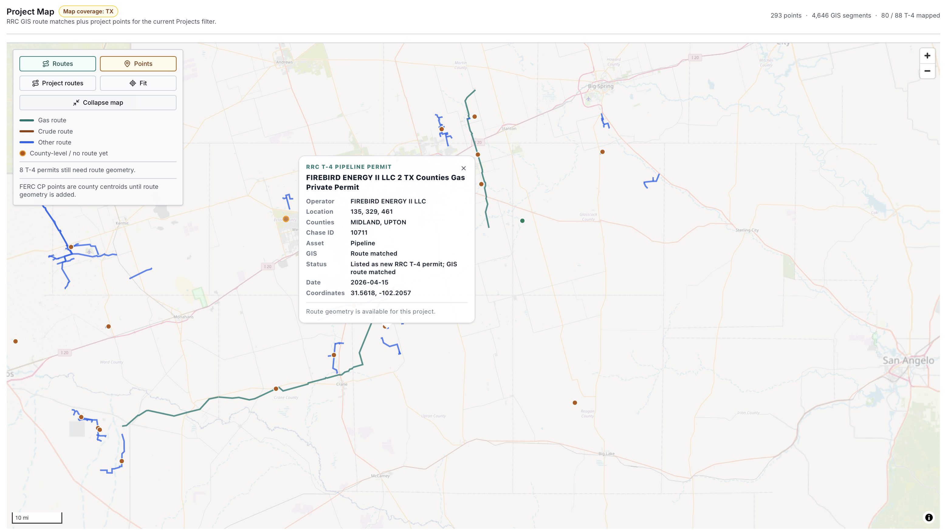
See how EnergyNetWatch connects pipeline permits, GIS route evidence, source records, facility data, maps, exports, alerts, and API workflows.

Texas pipeline permit route map example
Pipeline permits + GIS route context

AI data assistant

Ask the data for a source-aware brief.

Premium includes the EnergyNetWatch data assistant for plain-language questions across operators, permits, wells, production, infrastructure records, and coverage context. It keeps answers tied to available records instead of turning public data into unsupported claims.

Source-aware assistant
Included with Premium
Question

Build an infrastructure activity brief for Reeves County operators.

Records checked

Facility signals, permit context, operator labels, counties, and source timing.

Output

Shortlist, caveats, follow-up links, and report-ready source notes.

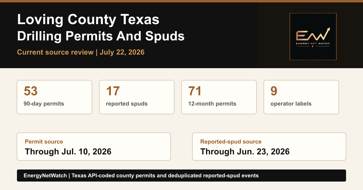
Loving County Texas Drilling Permits And Reported Spuds (2026) guide image
Read the featured guide

Featured guide

Loving County Texas Drilling Permits And Reported Spuds (2026)

Current Loving County Texas drilling permits: 79 recent permits, 14 reported spuds, operator labels, source dates, and lookup access.

Read guide

Platform

From public source files to usable energy intelligence.

Production and well data

State production records, well metadata, source caveats, and practical data access notes.

Permits and operators

Permit activity, operator context, counties, dates, and related development signals.

Maps and infrastructure

Map workflows, infrastructure context, alerts, and export-ready views inside the app.

Coverage

Multi-state coverage with clear caveats.

Coverage depth varies by state and source. EnergyNetWatch separates live app coverage, permit/API coverage, and broader public research coverage.

Public data guide coverage
26 states

State-by-state production data access, source formats, and availability notes.

Launch app coverage
14+ states

TX, NM, CO, CA, UT, WV, WY, AK, OK, PA, NY, ND, OH, LA

Permit/API coverage
13+ states

Permit-oriented workflows and API-supported state coverage.

Roadmap

See what is public now, how sample data differs from current app access, and which coverage notes we are preparing next.

View roadmap
26
state production-data landscape covered in public guides
14+
launch app states with selectable coverage today
13+
states covered by permit-oriented API workflows
724K+
Texas well records referenced in launch materials
Coverage depth varies by dataset. Not every state has identical production, permit, map, and workflow parity.

App access

Start EnergyNetWatch Premium.

The public site explains the sources and methods. Premium is $150/month for app access, maps, filters, alerts, exports, saved workflows, the source-aware data assistant, and an included API allowance. API-only access starts with prepaid credits from $50.
View pricing