
Static map view
Shows where a route, point, or facility sits. Useful for orientation, but often separated from source tables.
Turn midstream permits, GIS route evidence, and facility records into review-ready infrastructure workflows.
EnergyNetWatch connects pipeline permits, GIS route evidence, facility records, operators, counties, source dates, and public-record context so teams can move from a map signal to a record they can review, qualify, export, monitor, or access through API workflows.
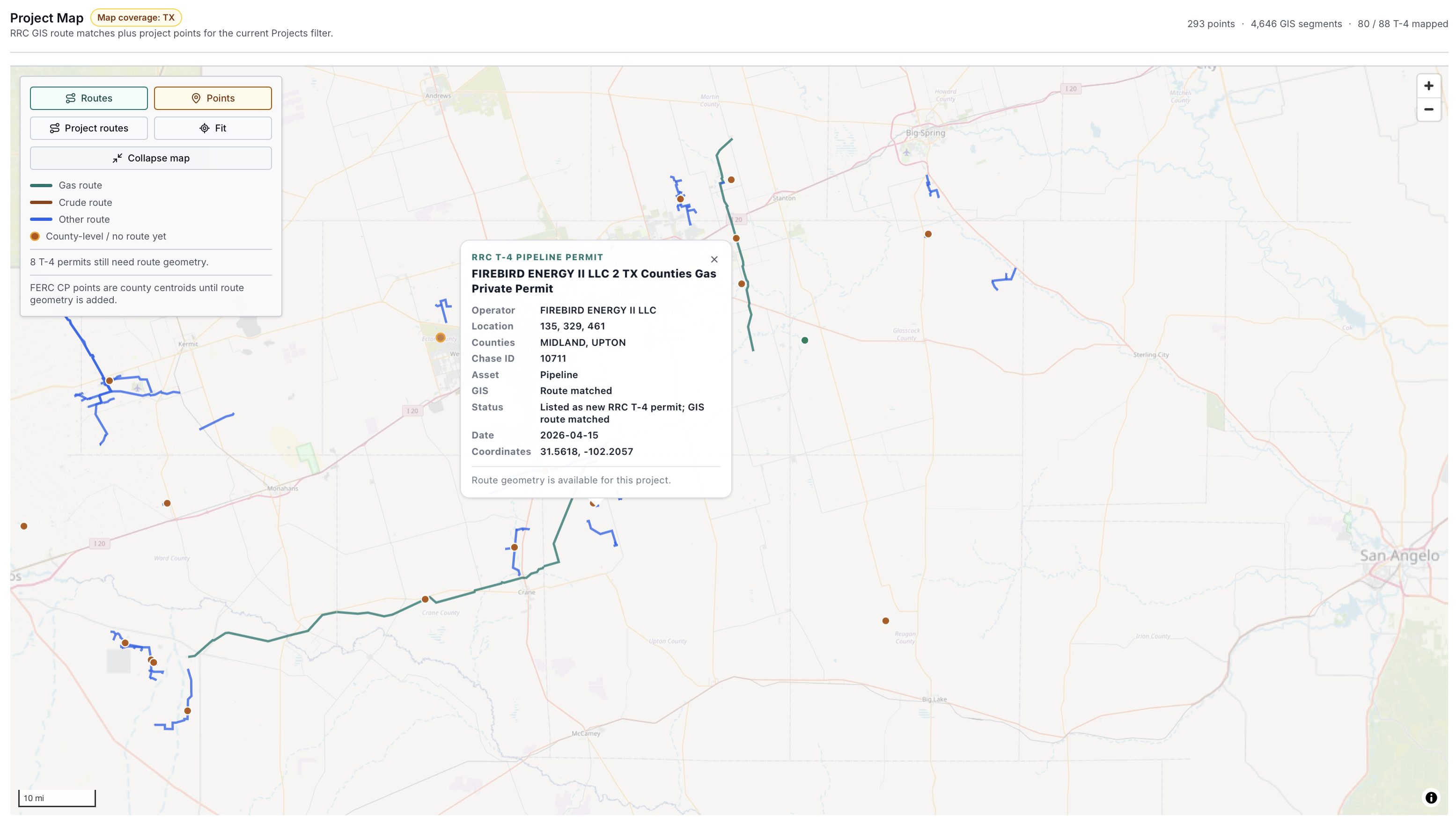
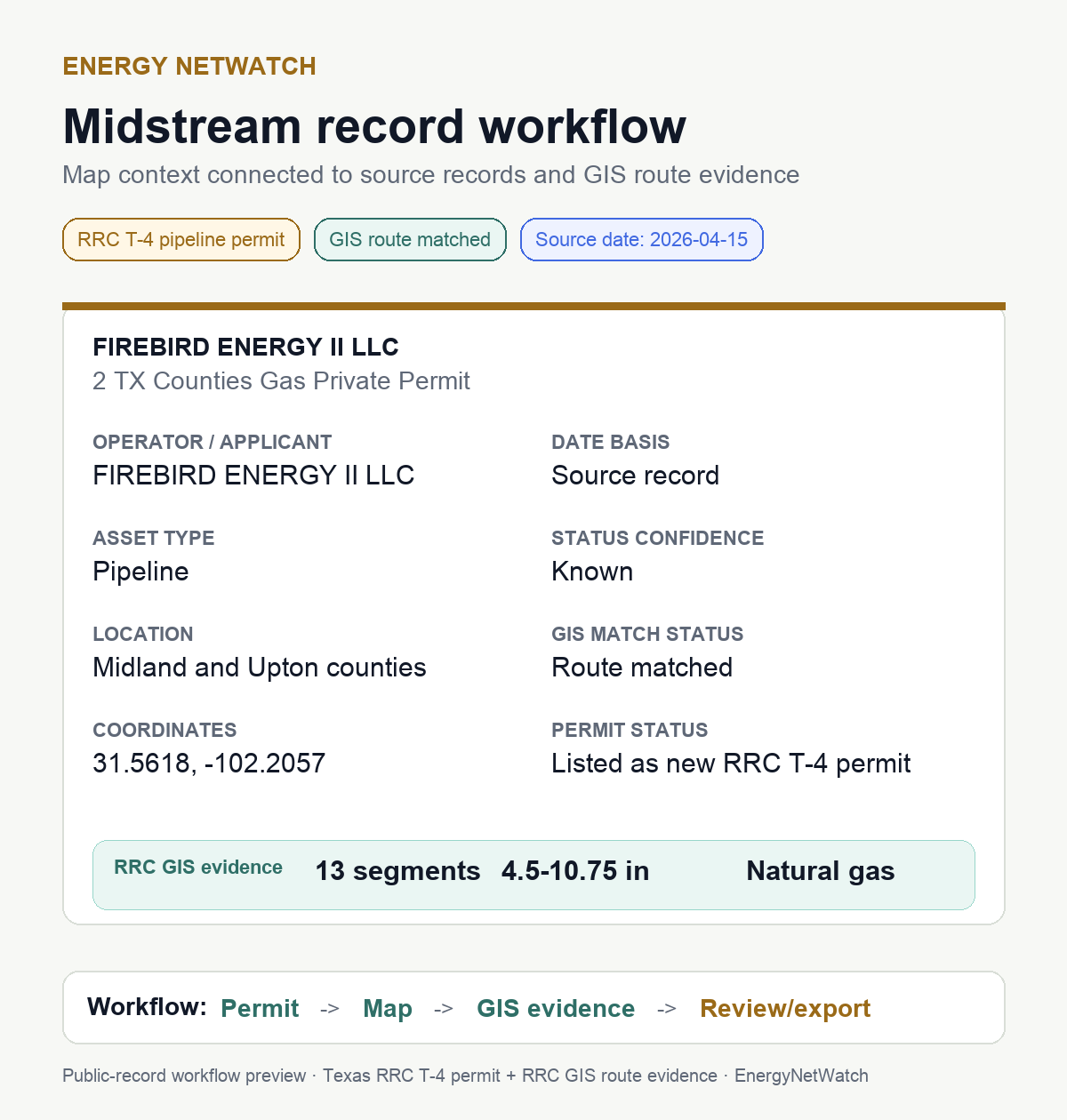
EnergyNetWatch is useful when infrastructure records become structured enough to review, filter, export, monitor, and explain. These fields turn a map layer into a working dataset.
| Data field | Example value | Why it is useful |
|---|---|---|
| Source family | Texas RRC T-4 pipeline permit | Separates pipeline permit records from drilling permits, facility records, production records, and federal docket signals. |
| Operator / applicant | Firebird Energy II LLC | Gives commercial, operating, and account ownership context. |
| Asset type | Pipeline | Helps separate pipeline signals from wells, tank batteries, plants, compressor stations, and other facilities. |
| Commodity | Natural gas | Helps teams separate gas gathering, crude, liquids, and other route contexts. |
| Source date | 2026-04-15 | Anchors the record to the source timeline instead of only the platform observation date. |
| Date basis | Source record | Clarifies whether the date comes from the public source, a platform observation, or another derived layer. |
| GIS match status | Route matched | Shows whether a permit row has been connected to route evidence. |
| Route segment count | 13 segments | Gives a quick measure of mapped route evidence for the selected record. |
| Diameter range | 4.5-10.75 inches | Helps qualify whether the line looks like small gathering, larger transport, or another infrastructure profile. |
| Counties | Midland and Upton counties | Supports county, basin, sales-territory, and nearby activity review. |
| Coordinates | 31.5618, -102.2057 | Lets analysts connect the record to map context and nearby records. |
| Status confidence | Known | Helps users understand whether the row is clean enough for follow-up or needs source review. |
These public-record examples show how raw Texas T-4 pipeline permit rows become more useful when connected to GIS route evidence and operator context.
| Permit / record | Operator | Counties | Commodity / class | GIS route evidence | Practical use |
|---|---|---|---|---|---|
| Firebird Energy II example | Firebird Energy II LLC | Midland, Upton | Natural gas / private pipeline | Route matched; 13 segments; 4.5-10.75 in. | Review gas infrastructure signal by operator, county, source date, and matched route context. |
| T-4 permit 10740 | Civitas Permian Operating, LLC | Glasscock, Howard | Gas / private pipeline | 15 segments; 4.5-16 in.; Foster/Tubb gas gathering | Connect a T-4 route lead to nearby permits, reported spuds, wells, and production context. |
| T-4 permit 10748 | Enterprise Products Operating LLC | Martin, Midland | Gas / private pipeline | 26 segments; 4.5-16 in.; Nail Ranch | Track a midstream operator signal in core Permian counties with route evidence. |
| T-4 permit 10765 | Diamondback E&P LLC | Midland | Gas / private pipeline | 14 segments; 4.5 in.; Buchanan Ranch Residue | Read operator-linked infrastructure context alongside Diamondback drilling and well activity. |
| T-4 permit 10766 | Plains Pipeline L.P. | Culberson, Loving, Winkler | Liquid / common carrier | 43 segments; 4.5-16 in.; Alpha Gathering | Review multi-county liquid infrastructure across Delaware Basin counties. |
These are source-level infrastructure leads. A route match does not automatically prove in-service status, final construction, economics, or commercial exposure. It gives the team a better starting point than a flat permit list.
The map provides location context. The report keeps the supporting source record, project classification, timing, and evidence limits attached to that location.
| Workflow step | EnergyNetWatch data layer | What the user can do |
|---|---|---|
| Find the source record | T-4 permit, facility record, gas plant record, or docket signal | Identify the operator, source family, location, and date basis. |
| Match to map context | GIS route, project point, county, coordinate, or facility location | See where the infrastructure signal sits and what area it affects. |
| Qualify the record | GIS match status, route segments, diameter, commodity, confidence, facility type | Separate direct project evidence from supporting infrastructure context. |
| Connect nearby activity | Wells, drilling permits, reported spuds, production, facility records | Understand whether the infrastructure signal sits near active upstream or facility activity. |
| Move to action | Export, saved workflow, alert, API access, account review | Turn a map signal into a repeatable review process. |
Report generated August 22, 2026; page reviewed August 24, 2026. Company and FAST-41 sources were captured August 21, TCEQ August 19, T-4 August 18, and the current PS-48 source file is dated July 20. Each source keeps its own clock.
| Report measure | Current value | Evidence boundary |
|---|---|---|
| Qualified project records | 121 | Every row meeting the published source and timing boundaries; no editorial row cap. |
| Named projects | 2 | One verified company project and one federal named project, kept separate from PS-48 notices. |
| Pipeline construction signals | 92 | Qualified Texas PS-48 construction-notice rows in the current report window. |
| Source-reported pipeline miles | 710.29 | Mileage reported by the qualifying pipeline records; not route geometry or completed mileage. |
| Facility activity records | 27 | Recent Texas TCEQ facility events that meet the report boundary. |
Named company and federal projects are included only when their own primary sources identify material scope. They are not presented as PS-48 filings unless an RRC construction notice supports that classification.
| Project | Publicly stated scope | Source basis | What is not established |
|---|---|---|---|
| Solitude Pipeline System | Two planned 48-inch pipelines from the Permian Basin to Katy; 4.5 Bcf/d disclosed in two phases. | August 17 company announcements | Approved to proceed; construction is not confirmed and customary approvals remain pending. |
| Texas Gateway | 155 miles of 36- and 42-inch pipeline plus new and modified compressor facilities. | FAST-41, FERC, and official project sources | Federal and company records identify scope and docket handles; they do not confirm current construction. |
| Team | Useful data | Practical question it helps answer |
|---|---|---|
| Midstream business development | T-4 permits, route matches, counties, operators, commodity, diameter | Which operators and counties show source-backed infrastructure signals worth reviewing? |
| Oilfield services and equipment | Facility records, source dates, facility types, nearby wells and permits | Where might gathering, compression, water, power, or field-service demand be forming? |
| Operators | Nearby permits, wells, production, facility records, source dates | What infrastructure context sits around current development areas? |
| Analysts and consultants | Source family, date basis, operator identity, route evidence, caveats | Which public records support the market or operator story? |
| Data and API teams | Structured fields, exports, source metadata, route evidence | Which records can be pulled into a repeatable data workflow? |
Shows where a route, point, or facility sits. Useful for orientation, but often separated from source tables.
Connects map context to permit, facility, source-date, operator, county, confidence, exports, alerts, and API workflows.
Specific Firebird example showing map context, T-4 permit data, GIS route evidence, source date, and record workflow.
Deeper methodology page explaining T-4 permits, route matching, a Civitas example, and nearby activity review.
Current qualified register combining named projects, PS-48 construction notices, and recent facility activity without treating supporting records as separate projects.
API access path for teams that need governed data workflows instead of manual screenshots or one-off exports.
Midstream infrastructure data includes pipeline permits, pipeline GIS route context, gas plant records, facility records, federal docket signals, operators, counties, source dates, commodities, diameter ranges, and related public-record fields used to review infrastructure activity.
Pipeline GIS data is geographic route or point context for pipeline infrastructure. It helps show where a route or asset sits and becomes more useful when connected to source records such as Texas RRC T-4 pipeline permits, facility records, or other public infrastructure signals.
A Texas RRC T-4 pipeline permit is a Texas pipeline permit record. It can identify operator, commodity, classification, location context, and pipeline attributes depending on the source record and related filings.
GIS route matching connects a source record to route evidence. That can add matched route segments, diameter range, commodity context, counties, system/operator context, and route-confidence information where the source data supports it.
No. A route match is geographic evidence tied to a source record. It does not independently establish in-service status, construction status, lifecycle history, or economics.
EnergyNetWatch is built around source-aware workflows, including maps, record review, exports, alerts, saved workflows, and API access where product coverage and customer access support them.
Review the current qualified project register, source links, evidence boundaries, and available exports.
View the current project report